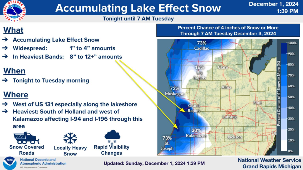
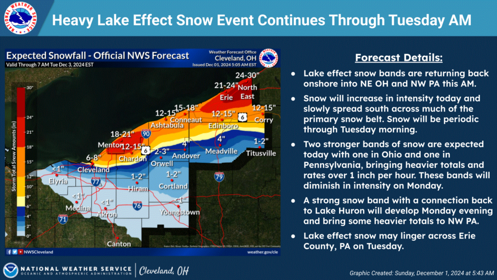
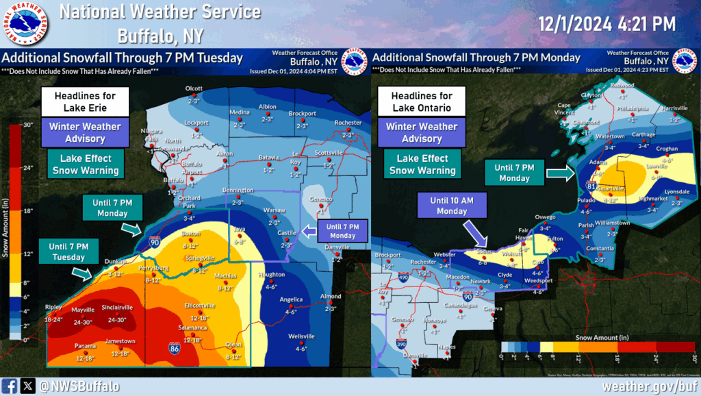
Winter storm alerts have been issued for regions along the shores of Lakes Michigan, Ontario, and Erie. Michigan’s west coast and areas near Lake Ontario are expected to receive up to a foot of snow, while cities around Lake Erie could see an astonishing 30 inches of snowfall.
What exactly is Lake Effect Snow?
Lake effect snow is common across the Great Lakes region during the late fall and winter, and according to weather.gov:
“Lake effect snow occurs when cold air, often originating from Canada, moves across the open waters of the Great Lakes. As the cold air passes over the unfrozen and relatively warm waters of the Great Lakes, warmth and moisture are transferred into the lowest portion of the atmosphere. The air rises, clouds form and grow into narrow band that produces 2 to 3 inches of snow per hour or more.”
Michigan’s West Coast
Significant snowfall is forecasted for the western part of Michigan, with high-resolution models indicating enhanced snow bands developing throughout Sunday night. Areas near Grand Rapids and just north of St. Joseph can expect 8 to 12 inches of snow. The snowfall will extend all the way to the northern tip of the Lower Peninsula and continue throughout Monday, lasting into Tuesday morning.

Lake Erie
The coast of Lake Erie is expected to receive the heaviest snowfall. The Erie, Pennsylvania area could see up to 22-30 inches of snow, with heavier bands impacting the coastline before calming down by Monday morning. Over in Ohio, some isolated areas may receive up to 21 inches of snow. According to NWS Cleveland: “The heavy band of lake-effect snow is slowly shifting back south, where it will again impact Erie County through Tuesday. Periods of snowfall rates of 1 to 2 inches per hour are possible.”

Off the Coast of Lake Ontario
Over on the New York coast of Lake Ontario, the Fair Haven area can expect up to 8 inches of snow, while the Smartville area may receive up to 12 inches. According to NWS Buffalo: “A prolonged and intense lake-effect snow event will continue through tonight. Lake snows will drift southward through tonight and then linger southeast of the lakes through Tuesday.” Snow bands from Lake Huron will bring brief snowfall, and Lake Ontario will contribute heavy snowfall to the areas, bringing snow all the way down to Rochester, NY. Through Monday night, a surface trough will move through Lake Ontario and likely disrupt snow showers. Snow is expected to return and continue through Wednesday.

Conclusion
This strong start marks the beginning of our winter season! Be sure to enjoy outdoor activities but stay safe and always follow the safety instructions provided by public service workers.
Work Cited
NWS – What is Lake Effect snow?
NWS Grand Rapids – Weather Story
NWS Buffalo – Weather Story
NWS Cleveland – Weather Story
NWS Grand Rapids – Forecast
NWS Buffalo – Forecast
NWS Cleveland – Forecast
